Trial of the Coastal IFOA
The NSW Government trialled some of the conditions proposed for the Coastal Integrated Forestry Operations Approval (IFOA) to assess how effective they were in an actual logging environment and ensure they were clear, efficient and enforceable.
The trial took place from July to September 2015 in five operational areas on the mid-north coast of NSW.
The trial tested different measures for protecting threatened species and their habitat, riparian areas, and tested different standards for harvesting intensity.
The Forestry Corporation of NSW (FCNSW) conducted the trial under the close supervision of the EPA and the Department of Primary Industries – Fisheries NSW to ensure any potential environmental impacts were minimised. A temporary amendment to the Lower North East IFOA permitted forest operations under different prescriptions to those normally required for the trial period only.
This table lists locations and documents regarding the trial of the proposed Coastal Integrated Forestry Operations Approval (Coastal IFOA).
The trial was restricted to a small number of harvesting sites in five state forests
- Queens Lake
- Lansdowne
- Kiwarrik
- Ingalba
- Styx River
Each site had three treatments applied
- The original IFOA requirements (status quo)
- Option A - the more flexible protection approach
- Option B - the most conservative protection approach
View the table of locations, original and trial harvest plans and original and trial harvest plan operational maps.
Assessment criteria were developed to evaluate the suitability of each landscape-based, stand-based and site-based threatened species measure. These criteria are detailed in the IFOA remake trial method (PDF 1.8MB), which also outlines the scope of the threatened species options and the settings that were applied at landscape-based, stand-based and site-based scales
FCNSW undertook all required threatened species pre-harvest surveys in accordance with current IFOA survey requirements. Their findings will be compared with the proposed landscape, stand and site based threatened species measures that were tested in the trial.
The government recognises the importance of having long-term monitoring to ensure that the IFOA is effective in protecting threatened species and habitats. A strategic long-term monitoring framework will be established as part of the Coastal IFOA to ensure that threatened species measures are effective.
Multi-scale landscape protection involves protecting threatened species habitat across the landscape, stand and site scales.
Landscape scale measures involve protecting large areas with environmental values that are excluded from harvesting, including high conservation old growth forests, rainforests, wetlands, streams and habitat corridors. Minimum thresholds are set to ensure habitat is retained.
Stand scale measures involves protecting important habitat and forest structural diversity throughout all harvest areas. Measures include
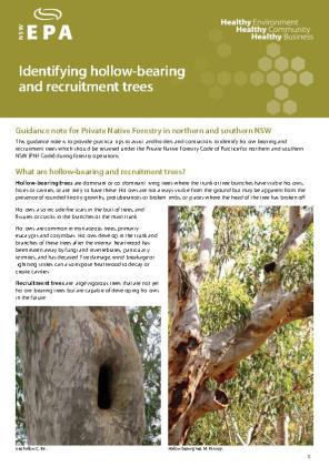
- retaining hollow-bearing, recruitment and feed trees
- setting minimum thresholds for retaining the forest structure (basal area)
- retaining small unharvested wildlife clumps for small animals to use as refuges
Site scale measures include specific protection measures in areas where a threated species has been recorded, such as exclusion zones around threatened plants, bird nests and bat roosts. Site scale measures would be required for species not catered for in landscape or stand scale measures and would be implemented where a threatened species or unique habitat is located based on survey results.
Landscape and stand scale measures will be implemented in every harvesting operation, whether or not threatened species records are present.
Protection zones are implemented around a stream network, to maintain corridors of undisturbed vegetation across the landscape, which provide habitat for wildlife and protect the aquatic environment by maintaining soil stability and sediment trapping.
The current IFOAs use the Strahler classification system, which assigns streams to an 'order' based on the number of tributaries (branches) associated with each stream; the larger the stream, the higher the order and the greater the protection measures to be applied.
The new LiDAR-mapped stream network contains many previously unmapped streams.
The trial tested a new classification system for LiDAR-mapped streams that assigned a 'class' to each stream based on the area of land (the catchment size) that drained into that stream. The 'class' determined the width of the riparian protection zones to be applied.
This means there were some changes to the widths of existing stream exclusion zones depending on the size of the catchment and the accuracy of previous mapping. The width of stream protection zones did not necessarily change at stream junctions, but at set catchment area thresholds at any place along the stream.
The measures applied in the trial resulted in no net change in the area of protected areas around streams.
To align with the new multi-scale approach to threatened species management, the trial set harvesting intensity limits on basal area removal and harvest return times. The requirement for specific silvicultural treatments (e.g. Australian Group Selection) under the current IFOAs was replaced with three zones that specified thresholds for harvesting intensity depending on past logging history, the regeneration needs of the forest and the structural diversity of the forest.
The thresholds were
- lower intensity harvesting practices (lower basal area removal) in the existing non-regrowth forest zone
- higher intensity harvesting (higher basal area removal) in blackbutt dominated areas in the existing regrowth zone
- lower intensity harvesting in all other areas in the regrowth zone
A range of ‘retained’ basal area thresholds, rather than 'removal' thresholds, were also tested during the trial, which may have delivered more intensive harvesting practices on a few trial sites.
The setting of thresholds for harvest basal area retention were assessed in combination with threatened species measures to ensure
- forest structural diversity, mature forest elements, and landscape connectivity were maintained during timber harvesting operations
- harvested areas could adequately regenerate while important ecological and habitat features of forests were being retained and protected
The trial was not related to FCNSW's proposed trial of timber harvesting on steep slopes. The steep slopes trial was not approved by the government.
The information obtained from the trial has been used to
- demonstrate ways in which the different provisions being trialled were effective in balancing ecological and forestry requirements
- assess how easy the provisions were to apply
- ensure the conditions were enforceable
- assess the different options for comparative environmental outcomes
- determine any wood supply consequences
- assess the operational efficiencies and costs for both the conduct of the operation and the EPA's assessment of compliance
The final report on the trial (PDF 2676KB) was exhibited for public consultation with the draft Coastal IFOA between 15 May - 13 July 2018.
See more information on the Coastal IFOA remake.


