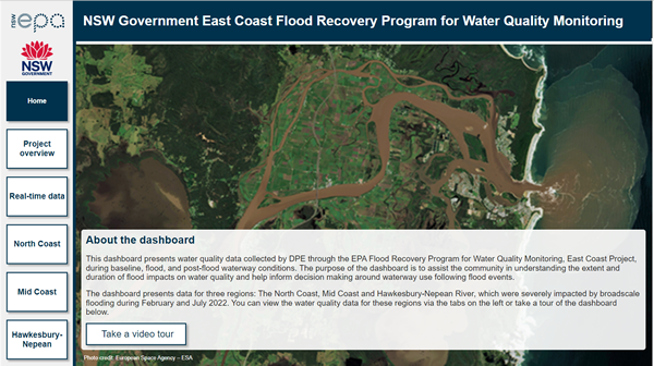
Flood recovery program for water quality monitoring - East Coast
A comprehensive program supporting long-term recovery from the 2022 floods by monitoring water quality in disaster-declared catchments along the East Coast of NSW.
The program is being delivered through 2 key projects:
- Guung Butherun (water stories) Project – Delivered by Jagun Alliance Aboriginal Corporation
- East Coast Flood Project – Delivered by NSW Department of Climate Change, Energy, Environment and Water.
The program is part of Regional NSW Riparian Stabilisation Package and funded by the joint Australian and NSW Government’s Disaster Recovery Funding Arrangements.
Jagun Alliance Aboriginal Corporation (Jagun Alliance) has been engaged to design and deliver a pilot Aboriginal knowledge project for the program by 30 June 2024.
The Guung Butherun (water stories) Project will provide a Cultural assessment of flood recovery in the Richmond River Catchment on Bundjalung Jagun (Country). From a Cultural perspective, the project recognises that the term ‘water quality monitoring’ can be more appropriately understood through Cultural indicators of river health, on Country knowledge practices and place-based experiences, all of which fosters opportunities for Knowledge sharing.
The project follows Buubaan Butherun (flood stories), a submission made by Oli Costello, Executive Director of Jagun Alliance, that provides personal insight into his relationship with Bundjalung Jagun and health of Country leading up to 2022 floods and forms Appendix F in the 2022 NSW Flood Inquiry.
Find out more about the Guung Butherun Project.
Key project activities
Between August 2023 and June 2024, Jagun Alliance will host a series of workshops and events for the Guung Butherun Project on Bundjalung Country.
The workshops will bring together community members and Aboriginal Knowledge holders in a culturally safe space to identify place-based water quality values and indicators, and discussions and activities to assess how these are recovering after the 2022 floods.
By walking, talking, and interacting with the river and by practicing Traditional knowledge, the project aims to spark dialogue, capture discussion around flood recovery within the region's community and build capacity to continue Cultural water quality monitoring beyond the life of the project.
Project objectives
The objectives of the Guung Butherun Project are to:
- create opportunities for connection and discussion by bringing Knowledge holders together on Country to provide custodianship
- enhance cultural governance for the duration of the project’s time frame in what is now known as the Richmond River Catchment.
The East Coast Flood Project, delivered by the NSW Department of Climate Change, Energy, the Environment and Water (DCCEEW), is delivering a water quality monitoring program across several flood-affected waterways listed under Australian Government Reference Number (AGRN) 1012 and 1025.
The project aims to:
- support environmental recovery through the provision of water quality data and information
- facilitate community and local government understanding of flood affected water quality and recovery timeframes
- identify potential sources of pollution
- drive evidence-based decisions on matters affecting waterways impacted by floods.
Key project activities
- Consolidate data from existing water quality monitoring programs and projects to generate water quality baselines for the focus regions.
- Manage a supplementary water quality monitoring program that fills gaps in water quality understanding for key rivers, creeks, and estuaries.
- Engage the community through citizen science projects that facilitate involvement in the monitoring and collection of water quality information for local waterways.
- Provide access to real-time water quality monitoring results and consolidated reports that facilitate understanding of flood impacted water quality, including recovery timeframes, for state and local governments, stakeholders, and the community.
Benefits of the project
The project will support long term environmental recovery from the February and July 2022 flood events by:
- improving understanding of the longer-term impacts of floods on water quality
- working with communities and waterway users to ensure local needs for information about water quality are met
- promoting evidence-based decision making and management
- improving stakeholder ability to identify and manage potential risk associated with natural disasters
- facilitating coordination and collaboration across agencies, projects and programs.
Monitoring methods
Water quality data is collected on a monthly, continuous, and periodic (event) basis to generate a comprehensive picture of pre-, during and post-flood water quality.
- Monthly – Routine water quality monitoring to build or expand datasets for each waterway
- Continuous – Real-time loggers in the priority waterways to provide continuous water quality data.
- Event – Water quality data collected during and immediately after events in flooded waterways.
The project monitors a suite of water quality parameters that are known to respond to flood events using specialised probes (see table below).
The team also collect water samples that are sent to the laboratory to measure the amount of suspended matter, nutrients, algae, and faecal indicator bacteria, including E. coli.
Stressors / Ecosystem receptors |
Parameter |
---|---|
Physico-chemical |
Temperature |
Dissolved oxygen |
|
pH |
|
Specific conductivity |
|
Salinity |
|
Turbidity |
|
Suspended solids |
Total suspended solids |
Nutrients |
Total nitrogen |
Total dissolved nitrogen |
|
Total phosphorous |
|
Total dissolved phosphorous |
|
Nitrogen oxides |
|
Ammonia |
|
Reactive phosphate |
|
Algal biomass |
Chlorophyll-a |
Faecal indicator bacteria |
Escherichia coli |
Enterococci |
Note: Parameters are not always measured at each site.
North Coast waterways monitored by the project:
LGA(s) |
System |
---|---|
Tweed Shire |
Tweed River |
Cudgen Creek |
|
Cudgera Creek |
|
Mooball Creek |
|
Byron Shire |
Brunswick River |
Richmond Valley, |
Richmond River |
Kyogle Shire, Clarence Valley, Coffs Harbour City |
Clarence River |
Coffs Harbour City |
Corindi River |
Moonee Creek |
|
Coffs Creek |
|
Boambee Creek |
|
Bonville Creek |
|
Bellinger Shire |
Bellinger River |
Nambucca Valley |
Nambucca River |
Kempsey Shire |
Macleay River |
Port Macquarie-Hastings |
Hastings River |
Mid Coast waterways monitored by the project.
LGA(s) |
Waterway |
---|---|
Port Macquarie-Hastings |
Camden Haven River |
Mid Coast |
Manning River |
Newcastle City, Maitland City, Port Stephens, Singleton, |
Hunter River |
Metropolitan Sydney waterways monitored by the project
LGA(s) |
Waterway |
---|---|
Blacktown City, Camden, Central Coast, Hawkesbury City, Penrith City, |
Hawkesbury-Nepean River |
Citizen science partnerships
A key component of the project is the collaboration with community organisations to develop or expand citizen science projects that are centred around improving understanding of waterway health.
Shifts in water quality due to flooding events may have acute and chronic impacts on ecological communities. Citizen science provides a unique opportunity to improve our understanding of the current state of key ecological indicators, including macroinvertebrate assemblages and riparian vegetation condition. This information will allow us to explore whether areas that experienced water quality impacts during the 2022 floods are showing evidence of ecological impacts or recovery.
Currently, projects are being delivered in 4 waterways in the far North Coast:
Brunswick River
Partner: Positive Change for Marine Life
Project: Rewilding our Floodplains Monitoring Project
In partnership with our project, Positive Change for Marine Life are expanding their ecological monitoring program to include freshwater macroinvertebrate sampling and a wetland monitoring program to assess the condition of mangrove habitat in the estuary. The results of this work will contribute to an ArcGIS StoryMap for the Brunswick River and will help us to interpret our results regarding water quality recovery following floods in this waterway.
Clarence River
Partner: OzFish
Project: Clarence River Fisher Science Project
In partnership with our project, OzFish are launching a new project focused on assessing water quality during and after rainfall using turbidity and water colour. Volunteers will collect water quality data over four months from August 2023 to December 2023. The data will help us to understand where sediment in the Clarence River may be coming from.
Richmond River
Partner: Richmond Riverkeepers
Project: Richmond River Ecological Health Program
In partnership with our project, Richmond Riverkeepers are expanding their recently developed monitoring program which assesses freshwater macroinvertebrate assemblages, riparian vegetation and water quality. Additional sites were added in October 2023, with health gradings calculated for each site and presented to the community via a report card. This partnership will support interpretations of flood impacts on water quality in the Richmond River.
Bellinger River
Partner: OzGreen
Project: Bellingen Riverwatch Program
In partnership with our project, OzGreen are expanding their water quality and freshwater macroinvertebrate monitoring program to involve more community members, improve volunteer training, and run a series of events to support the community to protect these rivers. This partnership will enable the impacts of floods on water quality to be interpreted alongside information on the ecological health of the Bellinger and Kalang Rivers.